
Photo: Annalea Hart


 Inspired by our Kid Hut Expeditions blog, the architect organization Bergen Arkitektforening (BAF) and newspaper Bergens Tidende (BT) have launched a competition to award the finest kid hut in Western Norway. Young architects and constructors are encouraged to send a photo of their "junior huts" to nyhetsweb@bt.no before the end of May.
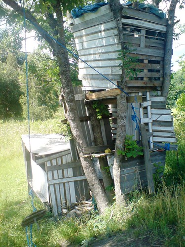
 Winter solitude--
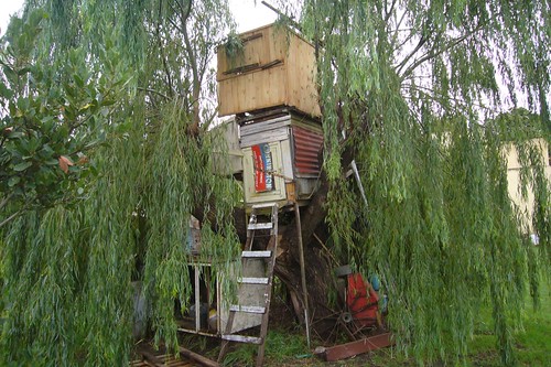 TO MAKE A DADAIST POEM
 Deep snow, packed hard by the wind, makes good ground for building the igloo, the snow dwelling of the Eskimo. To keep out the cold, every seam and gap in the igloo walls are chinked with snow. Complete within the hour.
 I'm dreaming of a white Christmas
 The Treehouse Song
 When I woke
I took the backdoor to my mind
and then I spoke
I counted all of the good things you are
and that list of charms was
longer than my chain of broken hearts
and when the day was done
I figured I had already lost
from the start – from the start
I was gonna love you till the end of all daytime
and I was gonna keep all our secret signs and our lullabies
I was made to believe that our love would grow old
we were gonna live in a treehouse and make babies
and we were gonna bury our ex-lovers and their ghosts
baby we were made of gold
Ane Brun, The Treehouse Song, 2008.
Photo: Jaafar Mestari
 Hamburg-Finkenwerder, Germany. Tdietmut
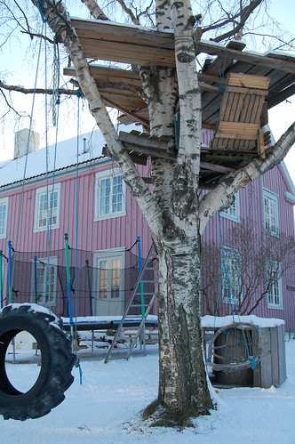 Rotvoll, Norway. Astridsol
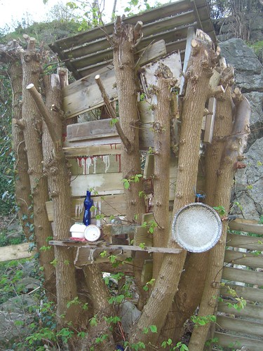 North Sea Cycle Route. Kalevkevad
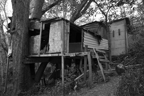
 Merzbau, Hannover 1933. Kurt Schwitters.

 Søm-Ruagerkilen Nature Reserve at Fevik, 2009.
 I sit and look
 I sit and look out upon all the sorrows of the world, and upon all
oppression and shame;
I hear secret convulsive sobs from young men, at anguish with
themselves, remorseful after deeds done;
I see, in low life, the mother misused by her children, dying,
neglected, gaunt, desperate;
I see the wife misused by her husband--I see the treacherous seducer
of young women;
I mark the ranklings of jealousy and unrequited love, attempted to be
hid--I see these sights on the earth;
I see the workings of battle, pestilence, tyranny--I see martyrs and
prisoners;
I observe a famine at sea--I observe the sailors casting lots who
shall be kill'd, to preserve the lives of the rest;
I observe the slights and degradations cast by arrogant persons upon
laborers, the poor, and upon negroes, and the like;
All these--All the meanness and agony without end, I sitting, look out
upon,
See, hear, and am silent.
Walt Whitman, Leaves of Grass - 1871 ed.
Photo: Majtek862
 I think that I shall never see
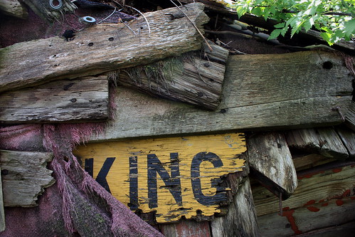
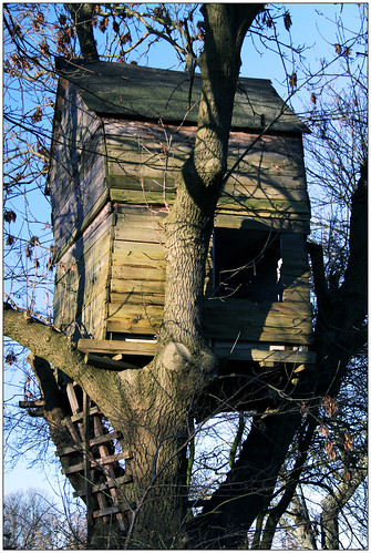
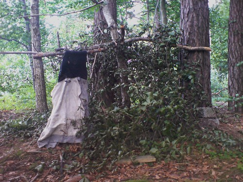
 At Lindesnes Bygdemuseum, this photo depicts two young architects that were never properly credited for their work. Around 1964 (judging from other contemporary photos), Atti Eikaas on the roof, and Odd Terje Vigeland in the doorway, built this magnificent hut. Now the photo is all that remains of it. Apparently, only buildings constructed by adults are worthy of preservation.
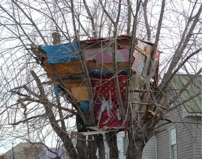
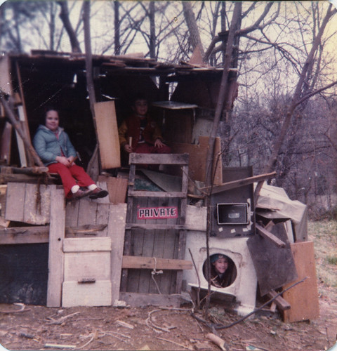 On the first of May, 1977, at latitude 38.893036 and longitude 77.10101, expedition member Ken Mayer came into the view of a camera lense. The 3-story monstrosity was built from scrap found along the I-66 right-of-way, where torn down houses and businesses along the former railroad line provided plenty of materials.
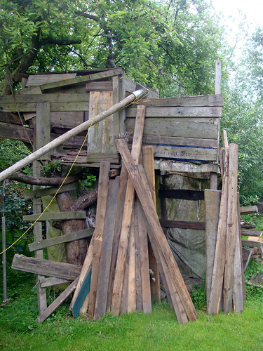
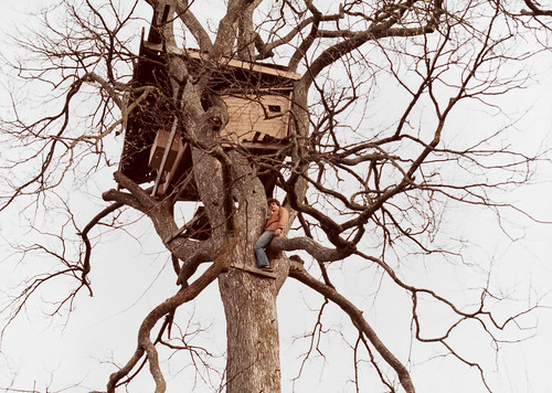
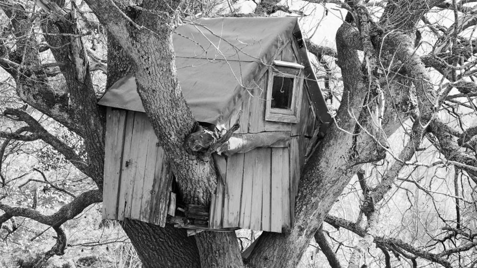
 In the forest, near "Aigle", Switzerland, artist and explorer Nicolas Geiser came across this kid hut on slim tree stilts, reachable by a long ladder made of two poles with plank steps. The hut is constructed so that no two boards are alike, nor of the same length. And the "door" is actually a rug. Creativity is the mother of invention.
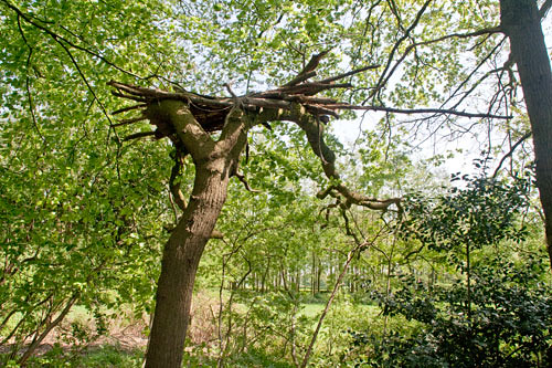
 Using our expedition boat, a GH 14 with a Yamaha 9,9 HP outboard motor, we are now able to navigate into unexplored bays and islets in the archipelago outside the South Coast of Norway. At Paradise Bay on the small island Havsøy outside of Arendal, a large Ash invited itself to be explored. Somebody had mounted a small swing from one of the branches. At the top of the tree we thought we could discern a small tree hut, but could not be sure from our position on the ground.
 Choosing a moment when no-one seemed near, we leapt sinuous and catlike, into the lower branches of the forest giant. Silently we climbed to a great height until we found a point where we could look through a leafy opening upon the scene beneath us.

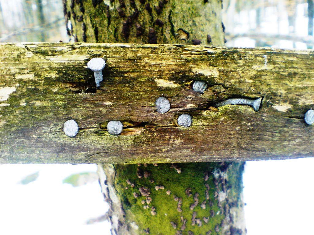
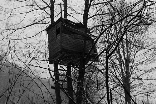
 We had now ascended to the structure we could discern from the ground, and from this angle we realized that it was more of a look-out tower at the top of the forest canopy than a proper hut. A floor, but no walls or roof, the structure was nevertheless sturdily built, and the bent spikes told the tale about the young builders. How on earth they had managed to get up there remained a mystery until we found remains of past ropes that in the past must have made the ascent at Paradise Bay a breeze.
 Ah, the wonders of MODERN SCIENCE! Thanks to the TECHNOLOGICAL ADVANCEMENTS of the 19th century, explorer Ian5281 has provided us with an anaglyph of a snow fort discovered in northwest Pennsylvania, US. This AMAZING STEREOSCOPIC IMAGE may be FULLY appreciated by explorers equipped with a standard set of 3d glasses, such as the one depicted below. NO EXPLORER WOULD DARE LEAVE HOME WITHOUT IT!


