9.7.09
Locality 38 (Arendal) Ascent at Paradise Bay
26.1.09
Locality 19: What the snow covered (Arendal)

It is not always the shortest way that is the best; here, in any case, it was to be hoped that another and longer one would offer better conditions. The shortest way was awful — possibly not altogether impracticable, if no better was to be found. First we had to work our way across a hard, forested slope, which formed an angle of 45 degrees, and ended in a huge, bottomless chasm. It was no great pleasure to cross over here on ski, but with heavily-laden sledges the enjoyment would be still less.
The prospect of seeing sledge, driver, and dogs slide down sideways and disappear into the abyss was a great one. We got across with whole skins on ski, and continued our exploration.

Partly concealed in the snow, we came across what appeared to us as an ancient Indian burial ground, similar to the ones found in the Mid-West parts of what is now USA.The fact that we were not able to find any remains of human bones at the site, may suggest that local birds of prey had already devoured the corpses according to custom.
20.10.08
Locality 17 (Arendal) The Hidden Valley
Upon our recent expedition in the Stinta area of Arendal we came across a hidden valley in the middle of an otherwise densely populated are on the outskirts of the small town centre. We had entered a marvelous canyon above what appeared to be several sites of abandoned ruins. A hidden path at Stintetoppen ran through a land of matchless charm. It had the majestic grandeur of the Canadian Rockies, as well as the startling beauty of the Nuuanu Pali near
In the variety of its charms the power of its spell, I know of no place in the world which can compare with it. Not only had it small peaks looming below the clouds overhead; gigantic precipices of many-coloured granite rising sheer for hundreds of feet above the valley, it had also, in striking contrast, orchids and tree ferns, the delectable beauty of luxurious vegetation and the mysterious witchery of the jungle. One was drawn irrisistibly onwards by ever-recurring surprises through a deep, winding gorge, turing and twisting past overhanging cliffs of considerable height.
Above all, there was the fascination of finding here and there under swaying vines, or perched on top of a beetling crag, the remains of a bygone race; and of trying to understand the bewildering romance of the ancient builders who, ages ago, sought refuge in a region which appears to have been expressly designed by nature as a sanctuary for the oppressed, a place where they might fearlessly and patiently give expression to their passion for wooden walls of passable beauty.
Traversing the valley, our expedition suddenly encountered a wild animal watching us from a ledge above the concealed jungle trail. One of the native porters suggested that this mysterious golden cat creature was an animal spirit, a ch’unel, a supernatural companion with an intertwined fate with a Shaman. The conclusion was drawn that the past valley inhabitants had somehow managed to transform themselves into animal spirits to protect the valley sanctuary which we were trespassing. While the porters abandoned our gear and hastily returned to their villages, the wild cat disappeared into the jungle never to be seen again.
11.9.08
Locality 16 (Arendal) Tree swing
2.7.08
Locality 13 (Arendal) Beware of fakes
Our team received a letter from a person who believed to have discovered the presence of a kid hut close to the town centre of Arendal. However, a survey revealed that whereas the small tree hut did initially resemble a kid hut, upon closer inspection it was obviously a fake. The sturdiness of the construction and its' general resemblance of surrounding houses gave it away. This construction was built by adults, for children. Beware of fakes.
5.6.08
Locality 12 (Arendal) Double ruins
The dense tree canopy seemed to make a roof somewhat superfluous. In fact, the dense vegetation which concealed the hut, the availability of building materials, and the exploratory possibilities within the ruins made the site an ideal spot for a kid hut. Condemned by the authorities, the site had probably nevertheless been secretly occupied for years.5.5.08
Locality 10 (Arendal). Tree hut and ski jump
16.3.08
Locality 08 (Arendal)
Passing through the old cemetery connected to the wooden Hisøy church, the ruins of an abandoned hut are visible from the road. Climbing a stone wall from the road, we moved through a small vegetative plateau, registering two artefacts possibly connected with the ruins: two transparent plastic jars, one containing the image of a pineapple. Other remains of activity were also found within the area, including rope and planks clinging on to weather-worn tree trunks.
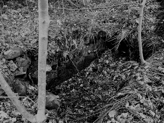
More omnious was the discovery of what may have been an opened tomb somewhat outside the area of the present cemetery. Measuring around 2,5x1,5 metres, a 0,5 m deep coffin-shaped depression in the stony ground was partially covered in foliage, making it easy to stumble into at night time. However, it was impossible to tell whence it had been exhumated. Supposedly, there may have been a church on the island since the middle ages, although it is unclear whether it was placed at the site of the present church. In any event, the discovery of the open tomb left the expedition crew apprehensive, and a discussion ensued on whether or not we should continue the climb towards the scattered ruins on top of the small hill.
Parts of the expedition setting up a temporary base camp at the vegetative plateau, the rest pushed on to make it up the hill before sunset. Half way up, a rope dangling from a tree down into the cemetery far below, may have provided a prior access point to the site, although it must indeed have been an arduous climb. Losing one's grip, one was sure to plunge into the abyss, leaving another corpse to be cared for at the cemetery.
The ruins themselves revealed no indication of the form or function of the site, but the composite character of the material, as well as the registration of the mentioned artefacts in the area, suggested that the site had once been a flourishing society of children. From the hill, the road towards Havsøy was clearly visible, indicating the strategic importance of the site. It was suggested by members of the expedition that the proximity to the unopened tomb may have contributed to the choice of abandoning the site, but it is unclear whether it was actually abandoned or destroyed by a hostile group. At this point, it is all conjecture.
9.3.08
Locality 06 and 07 (Arendal)
Two small sites were accidentally discovered during a recent routine excursion to Skibberheia at Hisøya in Arendal. Although not remarkable in themselves, the sites are of theoretical interest since they show evidence of not merely being abandoned, but also abandoned before completion. Furthermore, the sites seem to have been constructed for the sake of construction, rather than having a specific secondary purpose.Locality 06 simply consisted of two horizontal, once yellow but rather weather-worn planks attached to a slender pine tree by nails. Strangely, they were found approximately 2,6 metres up, with no visible clues as to how the builders were able to reach that height.
Locality 07 was somewhat more complex, consisting of several planks and two-by-fours, rope and nail, attached to a standard electricity pole. However, the structure was obviously incomplete by any standards.

Found within an area primarily, and rather densely, inhabited by seniors, it may be argued that the young builders of these two possibly related sites have engaged in an appropriation of their environment, finding the endeavor satisfactory in itself, and consequently abandoning the project before completion. An alternative hypothesis may be that the builders were unable to complete the projects. The sites may in fact be part of a complex nomadic pattern of relocation in which the builders spend part of their time with elder family members at certain intervals of the year.
5.3.08
Locality 05 (Arendal)
Some local inhabitants at Hisøya in Arendal had revealed the whereabouts of a pristine beach, marking the location on a map and reminding us not to get too close to the swans that often lurked in the native waters. The name of the area, Stølsvika, may translate as the bay of summer pastures, alternatively bay of dairy farm. However, at the time of the expedition there were not signs of domesticated animals of any species, nor any visible remains of the suggested farm. What we did discover, was the remains of a tree hut located very close to a beach front wooden house, and partly painted in the same colours; a rather intense shade of red. It should be noted that some planks were either unpainted or in a different more yellowish color, suggesting that the wooden planks had come from distinct sources.