25.3.08

Locality 09 ( Bergen)

At the crossroad where Amalie Skrams Vei and the lowest part of Formanns Vei meet, there is a cluster of maple trees (Acer platanoides). More precisely, there are three large ones and several smaller ones. Acer Platanoides is not particularly long-lived, with a maximum age of around 250 years.
These particular individuals grow in a 45 degree-angeled hillside covered with dirt and leaves showing signs of use as a local dirt path, passing from the upper living area in Sandviken down to the busy traffic street where you in fact find the access vein into the city centre.
Based on prior observations in the area, we infer that parts of the hut must have been constructed within the last three years, while older parts, including a blue swing rope attached to the southern tree, at least dates back to 1999. This makes it probable that the locality is still in use, not least evidenced by the presence of a red "flag" which not long ago must have been covering a young upper body as a t-shirt. The hut itself frugally ascends two of the biggest tree logs, and it is obvious that you must have the ability to be a good climber to master the challenges that this hut has to offer.
We may assume that this hut is perfect for overlooking Amalie Skrams Vei when pulling pranks on victims passing by, and whereas it may not contain the necessary objects for a complete disguise, at least you can swing yourself over to the southern tree in an effective getaway.
As such, the hut may serve as a sentinel post guarding or challenging the socio-economical border between the prosperous, villa-dominated higher end Sandviken, and the poorer lower end Sandviken with its' cheaper rental flats located next to the main traffic artery into the city centre.

16.3.08

Locality 08 (Arendal)

Passing through the old cemetery connected to the wooden Hisøy church, the ruins of an abandoned hut are visible from the road. Climbing a stone wall from the road, we moved through a small vegetative plateau, registering two artefacts possibly connected with the ruins: two transparent plastic jars, one containing the image of a pineapple. Other remains of activity were also found within the area, including rope and planks clinging on to weather-worn tree trunks.

More omnious was the discovery of what may have been an opened tomb somewhat outside the area of the present cemetery. Measuring around 2,5x1,5 metres, a 0,5 m deep coffin-shaped depression in the stony ground was partially covered in foliage, making it easy to stumble into at night time. However, it was impossible to tell whence it had been exhumated. Supposedly, there may have been a church on the island since the middle ages, although it is unclear whether it was placed at the site of the present church. In any event, the discovery of the open tomb left the expedition crew apprehensive, and a discussion ensued on whether or not we should continue the climb towards the scattered ruins on top of the small hill.

Parts of the expedition setting up a temporary base camp at the vegetative plateau, the rest pushed on to make it up the hill before sunset. Half way up, a rope dangling from a tree down into the cemetery far below, may have provided a prior access point to the site, although it must indeed have been an arduous climb. Losing one's grip, one was sure to plunge into the abyss, leaving another corpse to be cared for at the cemetery.

The ruins themselves revealed no indication of the form or function of the site, but the composite character of the material, as well as the registration of the mentioned artefacts in the area, suggested that the site had once been a flourishing society of children. From the hill, the road towards Havsøy was clearly visible, indicating the strategic importance of the site. It was suggested by members of the expedition that the proximity to the unopened tomb may have contributed to the choice of abandoning the site, but it is unclear whether it was actually abandoned or destroyed by a hostile group. At this point, it is all conjecture.

9.3.08

Locality 06 and 07 (Arendal)

Two small sites were accidentally discovered during a recent routine excursion to Skibberheia at Hisøya in Arendal. Although not remarkable in themselves, the sites are of theoretical interest since they show evidence of not merely being abandoned, but also abandoned before completion. Furthermore, the sites seem to have been constructed for the sake of construction, rather than having a specific secondary purpose.

Locality 06 simply consisted of two horizontal, once yellow but rather weather-worn planks attached to a slender pine tree by nails. Strangely, they were found approximately 2,6 metres up, with no visible clues as to how the builders were able to reach that height.

Locality 07 was somewhat more complex, consisting of several planks and two-by-fours, rope and nail, attached to a standard electricity pole. However, the structure was obviously incomplete by any standards.

Found within an area primarily, and rather densely, inhabited by seniors, it may be argued that the young builders of these two possibly related sites have engaged in an appropriation of their environment, finding the endeavor satisfactory in itself, and consequently abandoning the project before completion. An alternative hypothesis may be that the builders were unable to complete the projects. The sites may in fact be part of a complex nomadic pattern of relocation in which the builders spend part of their time with elder family members at certain intervals of the year.

5.3.08

Locality 05 (Arendal)

Some local inhabitants at Hisøya in Arendal had revealed the whereabouts of a pristine beach, marking the location on a map and reminding us not to get too close to the swans that often lurked in the native waters. The name of the area, Stølsvika, may translate as the bay of summer pastures, alternatively bay of dairy farm. However, at the time of the expedition there were not signs of domesticated animals of any species, nor any visible remains of the suggested farm. What we did discover, was the remains of a tree hut located very close to a beach front wooden house, and partly painted in the same colours; a rather intense shade of red. It should be noted that some planks were either unpainted or in a different more yellowish color, suggesting that the wooden planks had come from distinct sources.

The access to the tree hut proved somewhat of a mystery, and we did not feel confident to venture too close to the house proper to investigate further. This also implied that we were unable to make any excact measures of the location. From what we could discern of the structure, it seemed to consist of two adjoining parts supported on a rudimentary wooden platform resting on the branches of a single weather-worn pine tree. We noticed the presence of at least two glass-less windows which may have served as look-out points. The rather precise adjoining of the wooden planks in the walls suggested that an adult had supervised or even taken part in the construction. There were no signs of the builders although it was difficult to ascertain whether the site was abandoned or not.

27.2.08

Locality 04 (Bergen)

On the lower west side of the hidden mountain with the adventurous name: Dragefjellet [Dragon mountain] located in the city centre of Bergen, lays location 04.
We found the way trough narrow wood-housing and cobble stone roads, not to forget the crammed streets between concrete walls before the site suddenly appeared.

This loving space: a green garden with berry-bushes and white flowers laying solid at the end of a slope, the green grass that will soon be transformed into a protected football field on sunny days. This amazing and revealing fruit garden welcomed us and we immediately felt at home.

The hut is placed very solidly in the palm of a tree, holding and supporting the four walls that contains only wooden plank, the roof revealing itself as a more rational construction since it contains a dark green plastic coat, folded around the corner and tightened with a rope. This roof happens to be completely perfect for the rainy climate we have to fight here on the west coast of Norway.


Even though the position of the tree is close to a passing asphalt street, and traffic moves by, it is still a very protected and sealed off area.
It is needless to say that the builders of this site have spent a great deal of time to establish the calm and sensible atmosphere that the hut exists in, we suspect they may have constantly returned to the location to be present in this wonderful ambience.

Sadly we cannot recall observing any artifacts telling us anything about the builders’ use of the hut nor any evidence of spatial organization.

Locality 03 (Bergen)


The coastline throughout Sandviken used to host a wealth of industry. While some remains, there has been a more recent shift towards lucrative housing enterprises. At Sandviksboder 77-78, within the property of Rolf Olsen Saltimport a/s we registered a kid hut project located on a small overhanging cliff facing the sea. At the time it was surrounded by abandoned industry, inviting explorations within old and precarious structures housing vermin and mechanical monsters. Like these buildings, little remains of the hut at present.

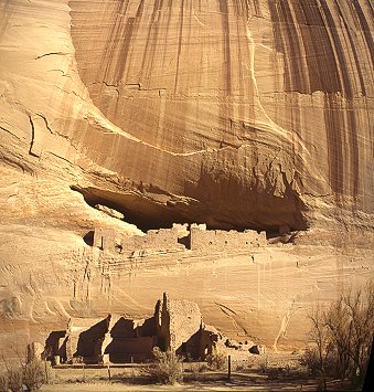
The site was located at a precipice which may have remained from previous demolition work in the area. A small shelf was accessible by climbing what resembled natural steps in the rock, housing several artefacts as well as a small provisory dwelling consisting of loose planks, rope and fur. Thus, the nature of the site was somewhat reminiscent of a miniature version of prehistoric Pueblo cliff dwellings in New Mexico and Arizona.


At the shelf we also found an old kitchen chair, but we were unable to determine its' proper age. Next to this, we also noticed an empty Coca-Cola bottle. Venturing to the south, balancing on a small crevice, we came across another part of the site which we imagined may have served as a kitchen, again concealing several artefacts which included a lamp shade stripped of fabric. The nature of the site and the plethora of abandoned artefacts made us concur that it is highly unlikely that this locality is connected to the previous localities, displaying markedly different cultural traits and craftmanship.

26.2.08

Locality 02 (Bergen)

The locality 02 (Bergen) was found in the vicinities of locality 01, but departing from Fjellveien further south. Half way up a steep foot path we came across a passage in which there was a need to make use of a long rope attached to an overlying tree limb to continue. This area featured far more trees and vegetative growth than at the previous location. There is reason to believe these trees also originate in the large scale municipal planting project some two hundred years ago, although of a different species and family.

On a small slope we encountered a somewhat concealed structure resting between several trees and elevated above the ground. Accessibility into the structure was by aid of small tree planks inserted into the sides of the trees to function as a provisory and most fragile ladder. The nature of this difficult access may support our suspicion that the site had been constructed by relatively young, but both clever and daring local children.


The hut consisted of at least three spacious levels, hanging from five pine trees and attached by relatively small nails and occasionally rope. What remained of walls and floors was mainly constructed by fine-cut tree plates, interspersed with heavy plates in corrugated iron, painted in checkered green. Sadly, we were unable to retrieve any artefacts from the site, leaving us with little knowledge about the function of the site, nor about the builders. However, a relatively small area seems rather densely dispersed with kid huts, suggesting that the various localities may be connected.

Locality 01 (Bergen)

We departed from Fjellveien, a traffic less dirt road ending in Sandviken, approximately 200 metres to the south of the location of an old power plant . A steep foot path led into the forested mountain which eventually towers above Sandviken, rising to 313 meters above sea level. The old stoned stairway known as Stoltzekleiven is found nearby; reportedly counting more than 800 steps. This monumental work is said to have been completed by unemployed youth after the second world war, improving the conditions of the existing foot path which may date much further bak in time. However, the present expedition explored regions somewhat lower and more southernly in the terrain.

The steep foot path proved difficult to traverse and tended to disappear altogether in certain parts. At some point we stumbled upon an old park bench which mysteriously had been dragged all the way up the hillside, necessitating transport across considerable distances. Needless to say, the laborers must have been quite fit because at this point we were presperating considerably, and the park bench proved a welcomed discovery.

After climbing for around an hour, we came across a small plateau which gave space to a cluster of trees of an unknown type. Apparently, all trees in this areas originate from abroad. Large-scale planting of trees occurred around two hundred years ago, establishing a somewhat forested landscape in lower parts of the mountains. However, the most surprising discovery was that an abandoned kid hut had been constructed at the site, being supported by five tall and sturdy trees and protected from a natural stone wall toward east, facing upwards. The discovery of a large tree plate in almost fosforent green on the northwest wall was something of a mystery to us, as we immediately recognized it from its' previous location much further north within the same area.


The hut, which may indeed have been originally conceived as a tower, consisted of five walls, one of which was left open to enable some sort of entrance. A small tree ladder led up to a small roof terrace with a splendid view of the surrounding area. Some of the trees contained undecipherable knife-engravings, mostly consisting of initials and symbols which we believe must date much further back. Lowering to enter the hut, we could discern nothing but two small plastic bread baskets inside, and later surveys revealed no more artefacts. It was as if the builders of the site had had plenty of time to remove all evidence of activity. A concealed path 200 meters north led to another locality which may have replaced the current site at some point. We are left to speculate about the reasons for the relocation and the intentions of the builders of the site.